cs-mask
Research
Methodology
Concerning the methodology different phases are distinghuished. At the onset of CS-MASK a quality control (QC) procedure will be developed in order to make the existing CS datasets (WOW, VLINDER, ...) useable. At a hectometric scale an improved representation of the land-atmosphere interactions might lead to better forecasts but only if detailed and accurate land information (land cover, building height,...) is used. Therefore we will evaluate which global, regional or local land information database is most advantageous for hectometric runs over Belgium. Secondly, AROME-SURFEX runs at 700 m resolution will be undertaken. August 2020, a month including some interesting high-impact weather events over Belgium, is selected as a case study to evaluate (based on the earlier developed QC CS database) the added value of these hectometric runs. Thanks to the significant fraction of urban observations in the CS data, this project provides a unique opportunity to experiment with the Town Energy Balance scheme that is used within SURFEX to model the urban-atmosphere interactions. Finally, UHI maps at different resolutions will be produced for Belgian cities for the August 2020 heatwave.
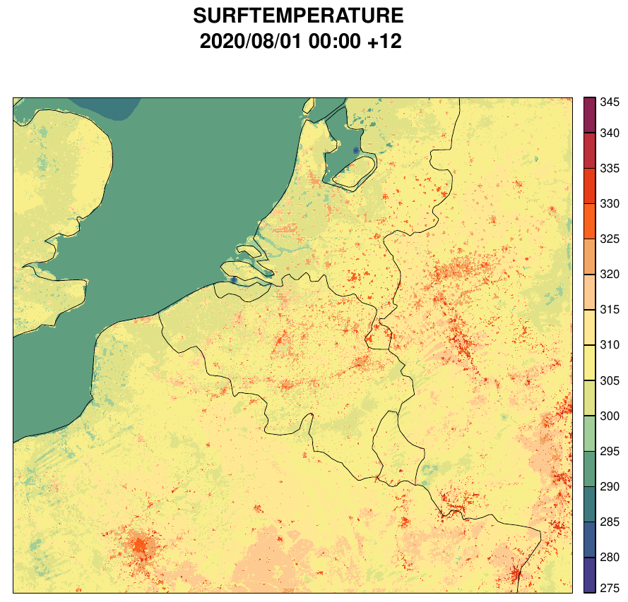
AROME-SURFEX-TEB at 700m resolution forecast (testrun). The surface temperature, in Kelvin, is presented of a 12-hour forecast at 01/08/2020 12h00 (UTC)
Strategic importance
The project is of large strategic importance for the IRM-KMI whose mission consists of providing accurate meteorological information over Belgium. In order to continue to offer the best forecasts in the future, the institute needs to prepare for the milestone of sub-kilometre weather modelling. This project represents a first exploration of such predictions for the IRM-KMI and makes the institute one of the pioneers in the field of high-resolution modelling. The scientific ambitions of the project are outspoken and the outcomes will be highly relevant for the atmospheric modelling community. The delivery of high-resolution UHI maps for Belgian cities is in line with the institute's ambition to provide climate services. These maps will be highly relevant for urban climate stakeholders (city planners, policy makers of local, regional or federal administrations, as well as companies). Finally, the successful use of CS data for weather forecasting could also convince Belgian citizens and local authorities to share more weather measurements.